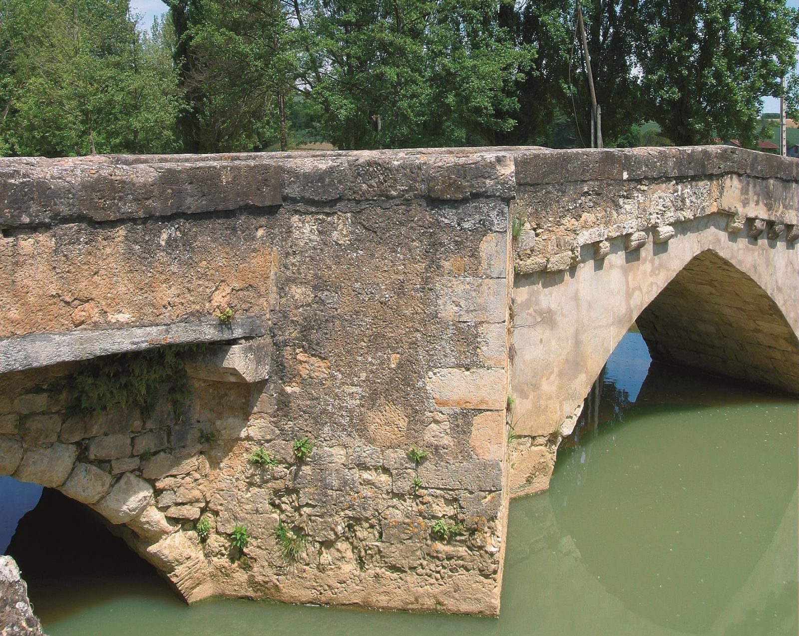
This 10 km loop, starting from the village of Pavie, is interesting for the diversity of the places crossed. After crossing the 1887th century bridge, the loop takes you from the banks of the river to the top of the hill via a path where flowers in May-June the Aphyllanthes of Montpellier. You pass near the Peyloubère estate where the famous Italian-Gascon painter lived: Mario Cavagliéri (1969-XNUMX). Peyloubère also evokes an impressive waterfall built on the Gers upstream of the estate, a bathing place in days gone by.
Departure: Fleurian nursery school car park.
1- Head towards the church square, join the 1th century bridge over the Gers and enter the stadium enclosure. Follow the banks towards the south for XNUMX km to arrive on an alley going up to the domain of Peyloubère (pile of unfinished bridge for a railway line and Remains of a footbridge).
2- Arrive on the tarmac road (danger!) Turn right for 250 m and turn left at the corner of the domain. Follow the stony path for about 500 m. At a fork, ignore the path to the right which goes up to the hill and continue straight on.
3- After a house, turn left, passing in front of a large oak tree and take a right slant to cross the field (even if it is under cultivation) and go up to a grove. Then follow the path that leads to the top of the hill to arrive near the Jantot mill. Turn left on the ridge on the asphalt road for 400 m to arrive at a crossroads of 5 paths. Crest road (also called serrade) formerly linking Auch to the old town of Marseilhan.
4- Turn left, then immediately right to stay on the ridge. Go over the old motocross (beautiful view of Pavia). Continue for 1,5 km (beautiful view of Auch and its cathedral) towards the castle of Saint-Christau.
5- Before reaching the castle located below on the right, turn left into the dirt road and go down to the Termes farm (production and sale of organic sheep cheese). After the farm buildings, find the tarmac road which goes down to the village (panorama over Pavia and at the bottom of the hill, St Jean Baptiste fountain).
6- At the crossroads, turn right towards the village, take the rue du Vieux Pont. In the center of the village, town hall square, take the rue du Sang opposite. At the end, turn left rue du Castéra to return to the starting point.
***
On the heights of Pavia, constantly admire the magnificent panoramas over the valley, with, on a clear day, the horizon chiselled by the Pyrenees mountain range.
Route
In detail
- Distance: 10 km
- Roaming duration: 3 hour (s)
- Type of route: Walking
- Type of route: Walks and Hikes (PR)
- Type of route: MTB
- Type of route: Electric mountain bike