Belleforest's plan - part 2
This plan is the oldest known plan of the city of Auch. We are continuing our series of 3 articles to tell you about this exceptional document: its origin, the portrait he draws of the city in the XNUMXth century and the way in which he testifies to the history of the city. These articles have been prepared with the indispensable contribution of Mr. Gilbert Sourbadère.
Part 2: Auch in the XNUMXth century
The city presented by Belleforest is therefore that of the end of the XNUMXth century, as the future discovered it Henri IV during his visit to Auch in 1578.
The plan makes it possible to imagine the density of the city, with half-timbered houses on several floors. However, we can see more open spaces with shrubs. Perhaps orchards where the famous Auch pears? One can all the same imagine winding alleys, cluttered by the stalls of the merchants, and which, in the absence of sewer, did not really invite to the walk.
First of all, it is important to point out that theplane orientation is wrong : East (East) and West (West) are reversed.
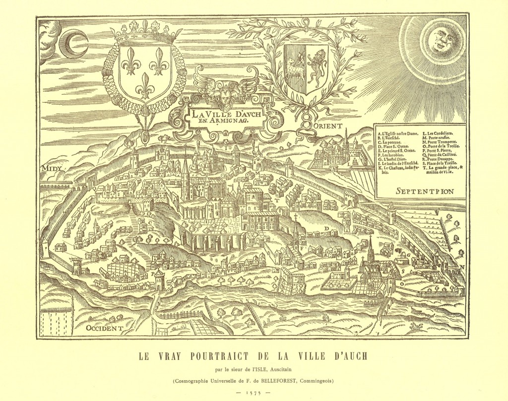
The legend of the map makes it possible to position the main monuments of the city and in particular the Cathedral, whose construction began in 1489. Consecrated in 1548, it does not yet have its porch or its towers.
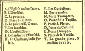
Around this Cathedral, you can see the two ramparts. 5 doors punctuate the small enclosure, and 11 doors the largest. This protects the 4 suburbs: Treille, Pouy, Saint-Pierre and Caillou. To date, only two gates to the city center remain: the Porte d'Arton and the Porte Neuve.
From the Porte d'Arton, we can see a “pousterle”, Very narrow and sloping alley, in steps, going down to the Gers which in the East (lower part of the plan).